![](/images/other/stat-length.png)
![Trail On foot Buchholz in der Nordheide - Wanderweg 1 Buchholz - Photo](https://media.geolcdn.com/t/1900/400/dc717e4c-352c-4b82-a12f-f978b6868904.jpeg&format=pjpeg&maxdim=2)
Wanderweg 1 Buchholz
SityTrail - itinéraires balisés pédestres
Tous les sentiers balisés d’Europe GUIDE+
![Length](/images/other/stat-length.png)
Length
21 km
![Max alt](https://static1.geolcdn.com/siteimages/upload/files/1508320355ic_sort_altitude_max_24dp.png)
Max alt
120 m
![Uphill gradient](https://static1.geolcdn.com/siteimages/upload/files/1508320355ic_sort_den_pos_24dp.png)
Uphill gradient
266 m
![Km-Effort](/images/other/stat-length.png)
Km-Effort
25 km
![Min alt](https://static1.geolcdn.com/siteimages/upload/files/1508320355ic_sort_altitude_min_24dp.png)
Min alt
44 m
![Downhill gradient](https://static1.geolcdn.com/siteimages/upload/files/1508320355ic_sort_den_neg_24dp.png)
Downhill gradient
274 m
![Boucle](https://static1.geolcdn.com/siteimages/upload/files/16400158638029165_repeat_loop_refresh_sync_direction_icon.png)
Boucle
No
Signpost
Creation date :
2022-02-11 13:13:45.476
Updated on :
2022-02-11 13:13:45.476
![On foot](https://static1.geolcdn.com/sitytour/trail-icons/100.png)
5h37
Difficulty : Medium
![Scan this QR Code to open this trail in the SityTrail application](https://capi.geolives.com/qq0zvz2zws4bq2lad0pu/sitytour/trails/3089606/qr.png?size=200)
FREE GPS app for hiking
About
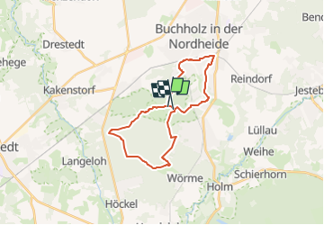
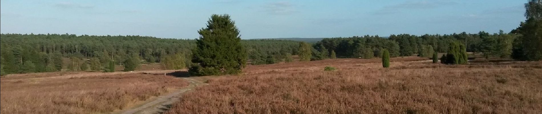
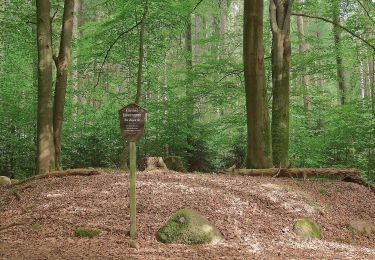
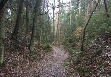
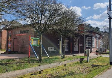
Trail On foot of 21 km to be discovered at Lower Saxony, Harburg, Buchholz in der Nordheide. This trail is proposed by SityTrail - itinéraires balisés pédestres.
Description
Trail created by Stadt Buchholz in der Nordheide.
Symbol: weisse 1 in grünem Kreis auf weissem Grund
Positioning
Country:
Germany
Region :
Lower Saxony
Department/Province :
Harburg
Municipality :
Buchholz in der Nordheide
Location:
Unknown
Start:(Dec)
Start:(UTM)
556187 ; 5906069 (32U) N.
Comments
Trails nearby
![Trail On foot Buchholz in der Nordheide - Wander-Tour Buchholz - Photo](https://media.geolcdn.com/t/375/260/6051b6ab-e6b0-492c-a525-895239c0195a.jpeg&format=jpg&maxdim=2)
![On foot On foot](https://static1.geolcdn.com/sitytour/trail-icons/100.png)
Wander-Tour Buchholz
On foot
Easy
Buchholz in der Nordheide,
Lower Saxony,
Harburg,
Germany
![](/images/other/stat-length.png)
4.2 km | 4.7 km-effort
1h 4min
![](https://static1.geolcdn.com/siteimages/upload/files/16400158638029165_repeat_loop_refresh_sync_direction_icon.png)
No
![Trail On foot Buchholz in der Nordheide - Buchholzer Rundwanderweg 3 - Photo](https://media.geolcdn.com/t/375/260/28e5ed77-e949-44e9-a047-fc9c80696c7c.jpeg&format=jpg&maxdim=2)
![On foot On foot](https://static1.geolcdn.com/sitytour/trail-icons/100.png)
Buchholzer Rundwanderweg 3
On foot
Easy
Buchholz in der Nordheide,
Lower Saxony,
Harburg,
Germany
![](/images/other/stat-length.png)
10 km | 11.4 km-effort
2h 35min
![](https://static1.geolcdn.com/siteimages/upload/files/16400158638029165_repeat_loop_refresh_sync_direction_icon.png)
No
![Trail On foot Buchholz in der Nordheide - Ho-Se Blauer Rundwanderweg - Photo](https://media.geolcdn.com/t/375/260/0b1df7cd-3876-47c5-a88e-a4686dce1f3f.jpeg&format=jpg&maxdim=2)
![On foot On foot](https://static1.geolcdn.com/sitytour/trail-icons/100.png)
Ho-Se Blauer Rundwanderweg
On foot
Easy
Buchholz in der Nordheide,
Lower Saxony,
Harburg,
Germany
![](/images/other/stat-length.png)
9.7 km | 10.8 km-effort
2h 26min
![](https://static1.geolcdn.com/siteimages/upload/files/16400158638029165_repeat_loop_refresh_sync_direction_icon.png)
No
![Trail On foot Buchholz in der Nordheide - Ho-Se Grüner Rundwanderweg - Photo](https://media.geolcdn.com/t/375/260/ae5dea94-e574-463b-9942-e09ffae2ceb4.jpeg&format=jpg&maxdim=2)
![On foot On foot](https://static1.geolcdn.com/sitytour/trail-icons/100.png)
Ho-Se Grüner Rundwanderweg
On foot
Easy
Buchholz in der Nordheide,
Lower Saxony,
Harburg,
Germany
![](/images/other/stat-length.png)
5.8 km | 6.4 km-effort
1h 27min
![](https://static1.geolcdn.com/siteimages/upload/files/16400158638029165_repeat_loop_refresh_sync_direction_icon.png)
No
![Trail On foot Buchholz in der Nordheide - Ho-Se Roter Rundwanderweg - Photo](https://media.geolcdn.com/t/375/260/276b6fcb-39d4-4545-a436-c142e45b3bc3.jpeg&format=jpg&maxdim=2)
![On foot On foot](https://static1.geolcdn.com/sitytour/trail-icons/100.png)
Ho-Se Roter Rundwanderweg
On foot
Easy
Buchholz in der Nordheide,
Lower Saxony,
Harburg,
Germany
![](/images/other/stat-length.png)
7.9 km | 9.3 km-effort
2h 6min
![](https://static1.geolcdn.com/siteimages/upload/files/16400158638029165_repeat_loop_refresh_sync_direction_icon.png)
Yes
![Trail On foot Buchholz in der Nordheide - Ho-Se Grauer Rundwanderweg - Photo](https://media.geolcdn.com/t/375/260/9f797c7f-f4f6-44f6-948a-d9eee7a342c9.jpeg&format=jpg&maxdim=2)
![On foot On foot](https://static1.geolcdn.com/sitytour/trail-icons/100.png)
Ho-Se Grauer Rundwanderweg
On foot
Easy
Buchholz in der Nordheide,
Lower Saxony,
Harburg,
Germany
![](/images/other/stat-length.png)
8.2 km | 9.2 km-effort
2h 4min
![](https://static1.geolcdn.com/siteimages/upload/files/16400158638029165_repeat_loop_refresh_sync_direction_icon.png)
Yes
![Trail On foot Buchholz in der Nordheide - Ho-Se Gelber Rundwanderweg - Photo](https://media.geolcdn.com/t/375/260/0b1df7cd-3876-47c5-a88e-a4686dce1f3f.jpeg&format=jpg&maxdim=2)
![On foot On foot](https://static1.geolcdn.com/sitytour/trail-icons/100.png)
Ho-Se Gelber Rundwanderweg
On foot
Easy
Buchholz in der Nordheide,
Lower Saxony,
Harburg,
Germany
![](/images/other/stat-length.png)
4.5 km | 4.9 km-effort
1h 7min
![](https://static1.geolcdn.com/siteimages/upload/files/16400158638029165_repeat_loop_refresh_sync_direction_icon.png)
Yes